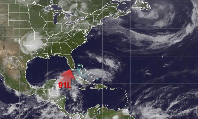
First tropical system for 2022 across the Atlantic Ocean: torrential rains and severe thunderstorms across the Caribbean Sea and Florida

The first organized tropical system for the Atlantic Ocean for 2022 began as a disturbance in southern Mexico on Wednesday. It spread torrential rain towards southern parts of Mexico and moved northeastwards towards the Gulf of Mexico and the Caribbean islands. The next few hours the disturbance is expected to become a tropical storm that will empowered the next days as it touches the warm waters of the Caribbean Sea.
Tropical Storm Warnings are now in effect for much of southern and central Florida, including the Florida Keys. Tropical-storm-force winds are likely to begin in Florida by tonight and early Saturday. See https://t.co/tW4KeGdBFb for more info. pic.twitter.com/USGWhSfcuN
— National Hurricane Center (@NHC_Atlantic) June 3, 2022
Already today is spreading heavy rain over northern Cuba and southern Florida. The tropical storm will move northeastwards tomorrow to Florida continue bringing severe thunderstorms to the Caribbean islands and Florida. During the next 3 days accumulation rates will be very high reaching totals for 3 days 150-200mm or locally more! Southern Florida and northern Cuba will experience locally flash floods. The weather system will be accompanied by strong winds and coastal flooding is possible. On Sunday as it will pass to the Atlantic Ocean influencing also the eastern coasts of Carolinas and Georgia. On Monday will move eastern towards the Atlantic and will be no more a threat.
On Tuesday the tropical cyclone will be upgraded to an extratropical cyclone with wind gusts that will reach more than 110 km/h.
