Atlantic Storm Ciaran: hurricane force wind gusts, waves up to 10m, severe weather and flood risk for western Europe and Italy
Pubblicato da
Emi Dinopoulou
in data
30/10/2023 - 16:37
2 min. di lettura
Livello - Per tutti
Condividi su
Meteo 2-3 novembre, la tempesta Ciaran raggiunge l'Europa
A low pressure system in eastern Canada will head eastwards towards Europe over the next 2 days and will become stronger, deeper, bringing severe weather from Wednesday night to western Europe and central-eastern over the next few days with the main characteristics of strong winds, high waves and intense showers.
Wind gusts of a hurricane force and waves of 9-11m: the deep low pressure system is named Storm Ciaran and is a dangerous storm as it will bring strong winds between Wednesday night and Thursday to northwestern Iberia, France, the southern UK and the Low Countries. In more detail, wind gusts will reach nearly 180-190 km/h which are reaching a category 3 hurricane wind force, while its sustainable winds will reach 120-140 km/h between Wednesday afternoon and Thursday morning southwest of the UK and west of France (on the sea) between the northeastern Atlantic Ocean and the Celtic Sea. Wind gusts will reach 140-150 km/h (a category 1 hurricane force) on Thursday between the northwestern coast of France and southern Wales- England. The strong winds are able to bring coastal flooding as the waves will be up to 9-11m so the coastline cities of Portugal, northern Spain, western France, the southern UK as well as Brussels and Holland should take precautions. This wind force is really unusual for Europe and it reminds us of the hurricanes of America, but at a lower intensity. The authorities are already warning of the damaging winds and they are preparing their houses to huddle the weather. In the map we could notice that the weather numerical model ECMWF is forecasting record wind gusts for this period.
potenziali raffiche di vento da record secondo Ecmwf
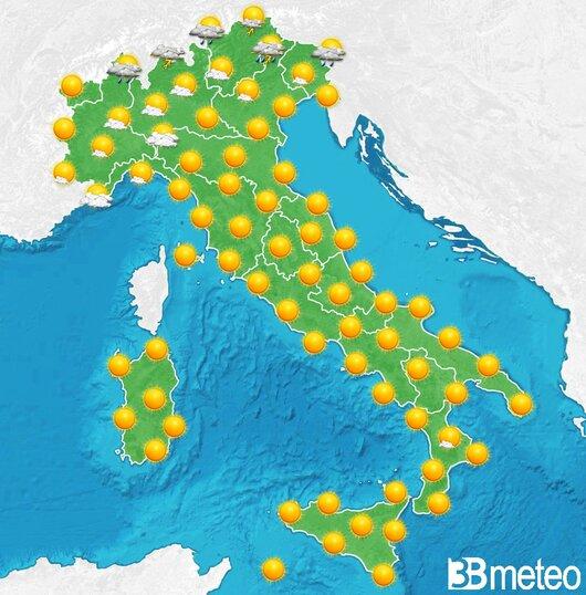
Severe weather and flash floods, 110-130mm in 24h in northern Italy: from Wednesday night to Thursday severe weather is expected to western Europe with intense rain, showers and thunderstorms as the Storm Ciaran will move northeastwards. The most severe weather will take place first in Iberia, France, the southern UK, while later in the Low Countries, the Alps, western Germany and northern Italy, while hail risk is also possible. Flash floods are possible to western Europe especially to northwestern Iberia, western France, Wales and England, while in Italy, especially between Liguria and Toscany and the northeastern regions of Italy accumulation rates will reach locally 110-130mm (Italy) in 24 hours on Thursday. On Friday, much of western and central Europe will have rain and showers, while severe weather will be expected in Italy, the Alps and the Balkans.
(1/) Increasing Model agreement this morning in respect to #Stormciaran which is currently developing from an embryonic Low over the NE United States, This low is developing as bitterly cold air has plunged SE across the Mid West & very warm tropical air has moved NNE along the pic.twitter.com/RIkxUPeBXl