Storm Elias in Greece is bringing flash floods, hail and a new danger for many regions

This month will always be remembered as one of the most historically difficult months for Greece, related to the severe weather events with unusually high accumulation rates, causing devastation. For the second time this month another severe weather system, called Elias, will bring high accumulation rates, thankfully not as high as Greece had during Storm Daniel, but high enough to cause new floods and great damages to the already affected areas.
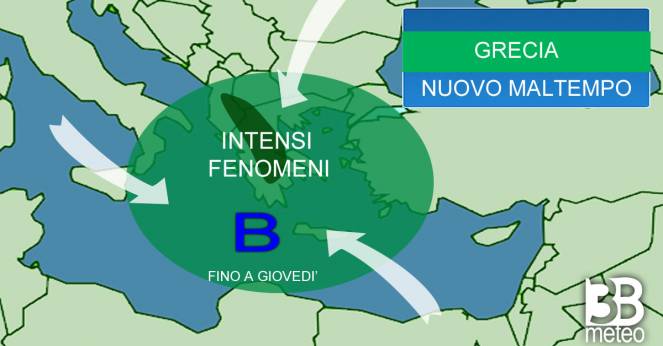
In more detail, a cold pool in the upper atmosphere over the Ionian Sea along with a surface low pressure system and a convection are responsible for the unstable weather between Italy and Greece. Already from yesterday Greece was affected by intense showers, while hail occurred in Achaia causing significant damages and traffic problems. In the afternoon, the storm brought rivers of mud into the new national road, causing traffic to stop.
Storm #Elias in Greece has produced very large and damaging hail, heavy rainfall and landslides that blocked one of the 3 main national roads on Monday 25 Sep 2023. pic.twitter.com/LqkOSvPC8F
— MedCyclones (@medcyclones) September 25, 2023
, - 17:55#Elias # pic.twitter.com/rXdm9qxSYQ
— Constantinos Matthaiopoulos (@Cosmat_) September 25, 2023
Today, Elias is bringing scattered showers and thunderstorms in Greece which will be more intense mainly across central and western regions. Unfortunately, many areas that were destroyed from Storm Daniel in Thessalia will again experience heavy showers or thunderstorms, thankfully not like last time. Other areas that will be influenced by severe weather are Lamia, Patras, Epirus (especially Arta and Amfilochia), northern Evia, northwestern Peloponnisos and the islands of the Ionian Sea. The accumulation rates of today already reached 70mm in Pezoula Karditsas and 90mm in Majrakomi Fthiotidas.
Tomorrow, Elias will bring scattered showers and thunderstorms in Greece, which will be more intense across central Greece, Chalkidiki, Thessaloniki, Peloponnisos, Athens, Cyclades and parts of western Crete. Thessalia, Magnisia, Sporades and northern Evia were some of the most hitted regions during the Storm Daniel and will experience severe weather also on Wednesday bringing new destructions. The winds will be northeastern moderate to strong, with gusts reaching 80-90km/h in the northern Aegean Sea.
Elias, according to the latest meteorological data, will bring accumulation rates near to 300-350mm (in 48h), mainly over the central regions and locally over northern Peloponnisos. The weather will continue to be unstable mostly until Friday, but the most severe weather will take place today and tomorrow.
